




 Lionel
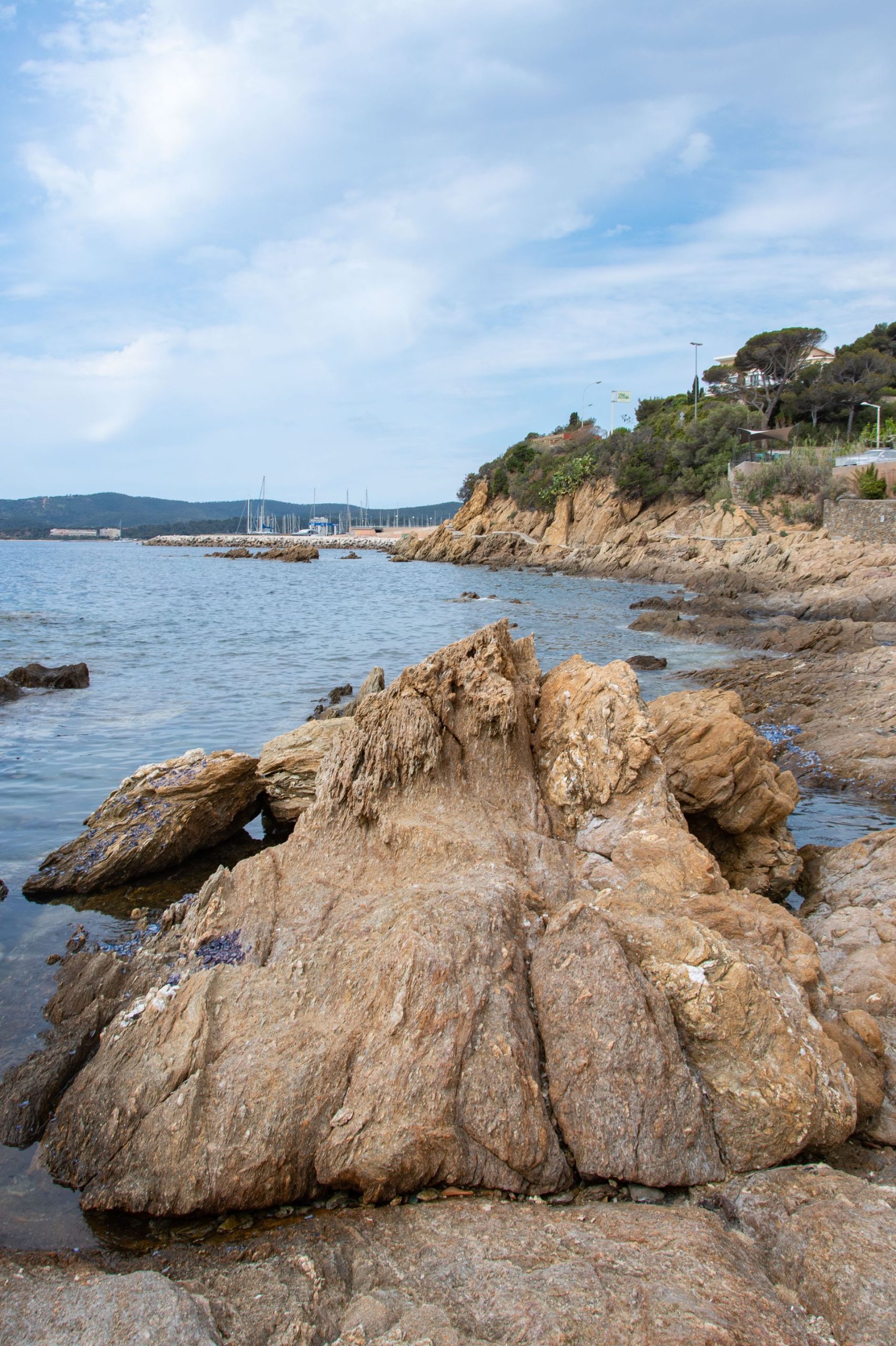
Between Bormes-les-Mimosas and Cavalaire, the Maures coast keeps its loveliest coves at the bottom of flights of steps you will never spot from a car. The secret comes down to three habits: leave the car in Le Lavandou and follow the old Train des Pignes railway line by bike; drive up to Collobrières on a Thursday or Sunday market morning; and, on summer evenings, check the daily map of which forests are open. Here is the area as you get to know it when you live on this side of the Var, with the best of the Le Lavandou beaches, Bormes and the forest behind them.
Updated October 2026
At a glance
- Where: the Var, from Bormes-les-Mimosas to Cavalaire-sur-Mer via Le Lavandou, Cavalière and Rayol-Canadel, plus the Maures hinterland and Collobrières.
- When: May–June and September–October for the sea; October for chestnuts; January to March for the mimosa.
- Getting there: the D559 runs the whole length of the corniche, and the coastal cycle path shadows it for much of the way.
- Best for: lovers of wild coves, unhurried cyclists, walkers, and anyone who likes the food of the forest.
- Good to know: in summer, access to the Massif des Maures depends on the day’s wildfire risk, and that includes some sites such as the Chartreuse de la Verne.
Why this corner of the Var is different
Here the Massif des Maures drops straight into the sea. There is no broad coastal plain, just a run of headlands, bays and small valleys cloaked in cork oaks. The corniche road snakes between the two, and every bend opens a new view of the Îles d’Or, the Golden Isles.
That terrain has protected the area. The beaches are many but small, often separated by rocks: Le Lavandou alone has twelve along a dozen or so kilometres of coast. Behind them, twenty minutes’ drive inland, Collobrières still lives off chestnuts and cork, and a former charterhouse hides deep in the forest.
The other asset is less obvious: the old railway that once linked Toulon and Saint-Raphaël. Turned into a cycle path, it takes you to the coves without the hunt for a roadside parking space.
Bormes-les-Mimosas, the village above the bay
Bormes joined the Plus Beaux Villages de France, the official list of France’s most beautiful villages, in September 2024. Perched at about 150 m, the old village is best explored on foot, through its covered passages, known locally as cuberts, and stepped lanes such as Rue Rompi Cuou, the oldest part of town.
- Don’t miss: the Chapelle Saint-François-de-Paule, built in 1560; the Église Saint-Trophyme and its restored sundial; and Place de l’Isclou d’Amour with its fountain and views over the harbour and islands.
- The Château des Seigneurs de Fos: it isn’t open to visitors, but the area around it gives the best panorama over the bay.
- Notre-Dame-de-Constance: a path climbs from the village to this chapel at 324 m, for an even wider view.
- Parking: the Saint-François car park is pay-and-display; the tourist office points to free spaces near the château and along Avenue Jean-Aicard. In season, blue zones require a parking disc.
The Fort de Brégançon, the official holiday residence of French presidents, also belongs to the commune. It can only be visited in season, with a guide, in small groups, and only by booking online or through the Bormes tourist offices: there is no ticket desk on site. The visit lasts about three hours, on foot. Tours are suspended in autumn; watch for bookings to reopen in spring.
Insider tip: head up to old Bormes on a Wednesday morning. The Provençal market is held in the village all year round, and you get the lanes to yourself before the midday wave of visitors. Being voted the French public’s “Favourite Village” in 2026 has noticeably swelled the crowds.
Le Lavandou: twelve beaches, and the best are below the road
Le Lavandou strings its fine-sand beaches from the town centre all the way to Pramousquier, on the border with Rayol-Canadel. The further east you go on the D559, the smaller and wilder they become. These are the ones worth the detour, from west to east.
Saint-Clair and the Grande Plage, for families
The Grande Plage, in the centre, and Saint-Clair, by the “whale rocks”, suit young children, who can stand up for a long way out. Saint-Clair, with turquoise water and golden sand, has lifeguards in season.
Aiguebelle, the shelter from the wind
This is the trick for mistral days. The tourist office notes that Aiguebelle, facing south-west, is usually sheltered from the mistral and from easterly winds, which makes it a good fallback when the other beaches are choppy.
Jean Blanc and the Éléphant, the hidden pair
Jean Blanc is a small beach of sand and rocks, a little over 5 km from the centre, shaded by vegetation. You reach it down a steep flight of around a hundred steps, with a viewpoint halfway down.
The real secret lies behind the rocks on the left. The Plage de l’Éléphant, which the tourist office nicknames “the wild one”, can only be reached by crossing Jean Blanc. Pale sand, turquoise water, shade and calm: it is one of the most beautiful coves in Le Lavandou.
- By car: take the D559 towards Saint-Tropez, past Aiguebelle; there are a few free, authorised spaces by the roadside.
- On foot from the road: follow the cycle path for about 200 m, take the steps on the right, then walk along Jean Blanc keeping to the left.
- By bike: from the centre, take the greenway towards Cavalière and leave your bike at the top of the steps.
Le Rossignol, “the secret one”
About 6 km from the centre, this fine-sand cove fringed with rocks is invisible from the road. It faces west, which makes it the sunset beach. Park on the bend, in the authorised spaces, then take a small path down to the coastal path and turn right. The tourist office warns that access is very difficult: closed shoes are essential, and forget the pushchair.
Le Layet, Cavalière and Pramousquier
Le Layet is the beach the tourist office lists as naturist. Cavalière, about a kilometre of sand, is the longest and most peaceful in the east of the commune, with kayak and paddleboard hire. Pramousquier closes the series, at the foot of the corniche.
- Dogs: on the small beaches such as Le Rossignol, the tourist office says they are only allowed from 1 November to 31 March.
- Safety: Saint-Clair and Cavalière have a lifeguard post in season; Aiguebelle, Jean Blanc, Pramousquier and Cap Nègre have emergency call points from 1 June to 30 September.
For more coves along the whole coast, see our selection of secret beaches of the Côte d’Azur.
The coastal cycle path, on the trail of the Train des Pignes
The Var coastal cycle route, the V65, links Hyères and Port Grimaud via La Londe-les-Maures, Le Lavandou, Cavalaire and La Croix-Valmer. For much of its length it follows the old Toulon–Saint-Raphaël railway. Between Le Lavandou and Cavalaire it takes over the trackbed of the Train des Pignes: tunnels and plunging views over the sea.
- The stretch to ride: from central Le Lavandou towards Cavalière, it serves Jean Blanc, the Éléphant, Le Rossignol and Le Layet directly.
- Surface: mixed; the official route sheet flags narrow and sometimes unsurfaced sections between Le Lavandou and Cavalaire.
- Difficulty: rated “moderate” by the regional tourism board. Some sections use or run alongside the road, notably around La Londe and between La Croix-Valmer and Port Cogolin.
Insider tip: in July and August, the handful of spaces along the D559 are gone by mid-morning. Park once and for all in Le Lavandou and tour the coves by bike: Jean Blanc, the Éléphant and Le Rossignol are all on the greenway, with no parking space to hunt for.
The Corniche des Maures: Rayol-Canadel and Cavalaire
The Domaine du Rayol, the garden of the Mediterraneans
Owned by the Conservatoire du Littoral, the national coastal protection agency, the estate covers 20 hectares facing the islands of Port-Cros National Park. On about 7 hectares, the landscape designer Gilles Clément has created a botanical journey through California, Chile, South Africa, Australia and the Canaries. Around 5 km of paths lead down to the estate’s beach. Allow at least an hour and a half.
- Opening: daily except 25 December, from 9.30am; closing time is later in spring and summer.
- Animals: only guide dogs are admitted.
- Don’t miss: some forty species of mimosa flower in winter; in summer the estate holds evening concerts and a guided coastal walk that must be booked.
- Programme and prices: at domainedurayol.org.
The corniche trails at Cavalaire
Leaving Cavalaire towards Le Rayol, an 8 km waymarked loop climbs above the Plage de Bonporteau and heads for the Pointe du Dattier. Allow about 3 hours and 360 m of ascent, with some steep sections. A short 3 km version turns back at the first viewpoint.
- Start: Plage de Bonporteau (parking along the D559, just after the last roundabout), or via the old railway line and its tunnel, about 2 km further on.
- Look out for: the cool, shady Vallon du Fenouillet, and Jupiter’s beard, a protected plant.
- Kit: walking shoes, water, and binoculars for the islands.
Cavalaire itself revolves around its long bay. Its Provençal market is held all year round on Wednesday mornings, on Place Jean-Moulin.
Port-Cros and Le Levant from Le Lavandou
Le Lavandou is the closest port to the two eastern islands of the archipelago. Vedettes Îles d’Or and Le Corsaire sail from the ferry terminal on Quai des Îles d’Or to Port-Cros and the Île du Levant. The crossing takes from 35 minutes to an hour, depending on the route.
- Season: sailings all year round, weather permitting. Out of season there are only a few departures a day, and some days have no boat at all.
- Booking: at vedettesilesdor.fr or on 04 94 71 01 02. You can book the outward trip and choose your return later.
- Animals: allowed on board, but access to Port-Cros is tightly regulated by the National Park: check before you set off.
Port-Cros can only be explored on foot, and Le Levant is largely a military zone. It is all covered in our guide Porquerolles, Port-Cros and the Golden Isles: a practical guide.
The Massif des Maures, the secret hinterland
Collobrières, chestnut capital
A winding road leaves the coast and plunges into chestnut and cork-oak woods. At the end of it lies Collobrières and its Pont-Vieux, an old bridge with no parapet above an impressive drop: keep an eye on children. Here the chestnut is king, and the Confiserie Azuréenne makes candied chestnuts (marrons glacés) and artisan chestnut spread.
- Market: Thursday and Sunday mornings, 8am to 1pm, on Place de la Mairie.
- Chestnut festivals (Fêtes de la Châtaigne): three Sundays in October. In 2026, they fell on 11, 18 and 25 October, 9am to 6pm, with a different theme each Sunday.
- On festival days: cars and bikes are banned from the village; there are paid car parks at the entrances and free shuttles from the west car park (parking Ouest).
- Tourist office: 1 Boulevard Charles-Caminat, 04 94 48 08 00.
The Chartreuse de la Verne, at the end of the forest
Founded in 1170, burnt down three times in the Middle Ages, sold off as state property in 1792 and then swallowed by vegetation, the charterhouse was restored from 1968. Since 1986, nuns of the Bethlehem family have lived here as hermits, in silence. The monastery can be visited freely, with a booklet handed out at the entrance.
- Access: a narrow, winding road crosses the massif; there is a free car park at the end, then about 700 m of flat track, around ten minutes on foot. Spaces are limited and coaches are banned.
- Closures: Tuesdays from All Saints’ Day (1 November) to 31 March, on religious holidays, and from June to September on days when wildfire risk closes the massif. January opening times vary: check before you go.
- Etiquette: monastic life goes on here, and visitors are asked to keep silent.
- On foot: a yellow-waymarked 10.4 km loop, about 4 hours and 468 m of ascent, starts from the charterhouse car park, a dozen or so kilometres from the village. Expect rocky, slippery sections under the trees.
Insider tip: on chestnut-festival Sundays, Collobrières village is closed to traffic. To reach the charterhouse on those days, the site itself recommends skirting the village via the D39 or the D14.
Summer access rules for the massif
Every summer, from roughly late June to late September, access to the Var’s forested massifs is regulated by prefectoral order (a decree from the département’s state authority). A map published every day at around 6pm, covering that day and the next, gives each massif a level.
- Green: access permitted.
- Yellow: access permitted.
- Orange: access not recommended.
- Red: access prohibited, except in designated public reception areas in the forest (ZAPEF).
- Black: access prohibited in all massifs.
Important: the map treats the Massif des Maures and the Corniche des Maures separately, and their levels can differ. A coastal path at Cavalaire may stay open while Collobrières is on red, and vice versa. Check the map at risque-prevention-incendie.fr/var the evening before, and set off early: the heat builds fast in the valleys.
More ideas for walks away from the crowds are gathered in our off-the-beaten-track walks and hikes.
Food and markets: the weekly calendar
The area lives off the sea and the forest: fish from the bay, chestnuts, honey, cork and the wines of the Maures. Here is the market schedule, according to the tourist offices. Days can change around festivals, so check before you travel.
- Wednesday: Bormes-les-Mimosas (old village, all year); Cavalaire-sur-Mer (Place Jean-Moulin, all year, 8.30am–1pm).
- Thursday: Le Lavandou (Avenue Vincent-Auriol, all year, 8am–1pm); Collobrières (Place de la Mairie, 8am–1pm).
- Saturday: Bormes, in the La Favière district near the harbour and beaches, in season.
- Sunday: Collobrières; La Londe-les-Maures, in the morning.
- Summer evenings: night craft markets at La Favière and in old Bormes.
To take home: candied chestnuts and chestnut spread from Collobrières, a Maures honey, and a bottle from a La Londe or Bormes estate. For the Provençal traditions that mark the year, read our feature on culture and traditions of the Côte d’Azur.
When to go (and why to try the off season)
- January–March: mimosa blooms on the hills of Bormes and at the Domaine du Rayol. Bormes is the starting point of the Route du Mimosa and holds its flower parade (corso fleuri) in February.
- April–June: the best season for walking and cycling. The massif is open, the rockroses are in flower and the coves are still quiet.
- July–August: the area is very busy. Live against the clock: a cove before 9am, a siesta, a hilltop village in the evening. And check the massif map every evening.
- September–October: the sea stays warm, the beaches empty and the chestnuts fall. The three festival Sundays in Collobrières round off the season.
- November–December: boats to the islands still run, with few sailings. The massif is open with no wildfire restrictions, and the year-round markets carry on.
Our itinerary along the Route du Mimosa from Bormes to Grasse covers the winter season in detail.
Getting around and parking
The whole coast is served by a single road, the D559, which quickly clogs up in summer between Le Lavandou and Cavalaire. Roadside spaces giving access to the coves are scarce. A few simple rules will save you from driving in circles.
- One base, one bike: park in Le Lavandou or Cavalaire and explore along the coastal cycle path.
- Bormes village: pay-and-display at the Saint-François car park, free spaces near the château and on Avenue Jean-Aicard, and a parking disc compulsory in blue zones in summer.
- Domaine du Rayol: free car park in front of the entrance, and a second one about 400 m away along the greenway. Bus line 878 serves Le Rayol.
- Chartreuse de la Verne: narrow road, few spaces; arrive at opening time.
- Collobrières on a festival day: leave the car in the car parks at the entrances and take the shuttle.
Where to stay
To explore the coves by bike, stay in Le Lavandou, Cavalière or Cavalaire; for peace and sunsets, choose a B&B (chambre d’hôtes) in old Bormes or a house among the chestnut trees around Collobrières, and consider the campsites near Aiguebelle and La Favière.
Our hand-picked campsites in the area, on Yes I Camp: Camp du Domaine (Bormes-les-Mimosas) and Le Pansard (La Londe-les-Maures).
See also all our campsites in Provence-Alpes-Côte d’Azur on Yes I Camp.
FAQ
Can you walk in the Massif des Maures in summer?
Yes, depending on the day’s risk level. From roughly late June to late September, the Var prefecture publishes a daily access map for each massif at around 6pm. On orange, access is not recommended; on red, it is prohibited outside designated areas; on black, all massifs are closed. The Chartreuse de la Verne also closes on days when the massif is shut.
Which is the quietest beach in Le Lavandou?
The small beaches in the east of the commune, reached by steps or a path: the Éléphant, which you get to by crossing Jean Blanc, and Le Rossignol, below the road. When the mistral blows, fall back on Aiguebelle, which is usually sheltered.
How do you get to Port-Cros from Le Lavandou?
Vedettes Îles d’Or and Le Corsaire sail from Le Lavandou’s ferry terminal to Port-Cros and Le Levant all year round, weather permitting. The crossing takes 35 minutes to an hour. Book at vedettesilesdor.fr, especially in summer.
Which days are the markets in Bormes and Le Lavandou?
Wednesday morning in old Bormes, all year round, and Thursday morning in Le Lavandou. In summer, add Saturday morning at La Favière. Collobrières holds its market on Thursday and Sunday mornings.
When are the chestnut festivals in Collobrières?
On three Sundays in October. In 2026 they were held on 11, 18 and 25 October. The village is closed to cars on those days, with free shuttles from the car parks at the entrances. Dates for the next edition are published by the Collobrières tourist office.
Further reading
- Porquerolles, Port-Cros and the Golden Isles: a practical guide
- The secret Gulf of Saint-Tropez: an insider’s guide
- The secret Estérel: red-rock coves, trails and villages
- The Calanques and Cassis, the insider’s way
- The Mimosa Route from Bormes to Grasse in 3 days
- The most beautiful hill villages of the French Riviera
- 15 off-the-beaten-track hikes on the French Riviera