




 Lionel
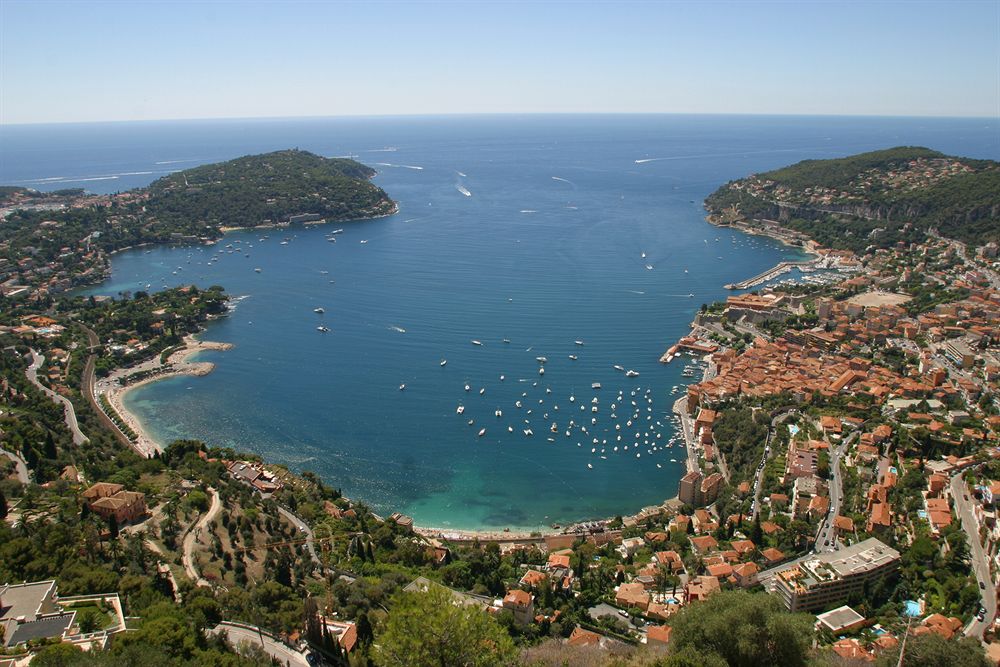
Quiet coves still exist on the Riviera, but you have to earn them: a steep flight of steps, an hour on a footpath, an early-morning boat or a little regional train that stops in the middle of the Estérel. Here are eighteen beaches and calanques, from Cassis to the Italian border, each with how to get there and the best time to go.
Updated October 2026
At a glance
- Where: the whole coastline, from the calanques of Cassis to Cap Martin, including the Golden Isles (îles d’Or) and the Lérins Islands.
- When: May–June and September–October for peace and quiet; in summer, before 10am or late in the afternoon.
- Access: almost always on foot (from 5 minutes to 1 hour 30), sometimes by boat or train.
- Rules: summer booking at Sugiton, possible closure of the hills and forests when the wildfire risk is high, and a daily visitor cap on the Golden Isles in high season.
- For whom: well-equipped walkers, snorkellers and anyone happy to get up early.
Before you go: three rules to know
In the Bouches-du-Rhône département, access to the forested massifs is regulated from 1 June to 30 September. Every evening at around 6pm, the prefecture (the local state authority) publishes the map for the following day: each massif, including the Calanques, is either open or closed for the whole day. In the Var, the prefecture posts its daily map online before 7pm, from mid-June to the end of September. For the Calanques, the National Park’s “Mes Calanques” app also sends real-time alerts.
Second rule: some coves have visitor quotas. That is the case for Sugiton in summer, and for the islands of Porquerolles and Port-Cros in high season. Third rule: there are no facilities on site. Allow two litres of water per person, proper shoes and a bag to take your rubbish home.
1. Calanque d’En-Vau (Cassis)
The most spectacular of the calanques – the narrow, cliff-lined inlets of this coast – enclosed by towering white cliffs. Sand and pebbles give way to water of an almost unreal green. You reach it from Port-Miou, the Cassis gateway to the Calanques National Park.
- Access: about 1 hour to 1 hour 30 on foot from Port-Miou. The final descent is steep and slippery, and sometimes calls for your hands.
- Parking: avoid the centre of Cassis; the free Gorguettes park-and-ride is linked by shuttle to the park entrance.
- Best time: set off in the cool of the morning, before the heat sets in.
2. Port-Pin (Cassis)
En-Vau’s little sister, quicker to reach and fringed with Aleppo pines. A good option with children who can walk, or for an end-of-day swim.
- Access: around fifteen minutes beyond the Port-Miou entrance, according to the National Park.
- Good to know: the beach is small and fills up fast in July and August.
3. Calanque de Sugiton (Marseille)
Two tiny coves facing the Torpilleur rock. The water is cool and crystal clear. A victim of its own success, the site requires a booking in summer.
- Access: bus B1 to the “Luminy – PN des Calanques” stop, then about 45 minutes downhill. The climb back up takes at least an hour.
- Booking: free and compulsory on the dates set by the park. In 2026: 20–21 June, every day from 27 June to 30 August, then the weekends of 5–6 and 12–13 September, with 400 places a day (Sugiton and Pierres Tombées).
- Best time: outside the regulated period, access is unrestricted. A weekday in September is ideal.
Insider tip: at Sugiton, booking opens three days ahead (at 9am, three days before) and closes at 6pm the day before. One booking covers up to five people, and it is cancelled automatically if the massif is closed because of the wildfire risk. No need to watch the website weeks in advance.
4. Calanque de Marseilleveyre (Marseille)
The closest calanque to the city, with its pebble-and-sand beach, a dozen or so cabanons (traditional fishermen’s huts) and a guinguette – a simple beach café – with no electricity, open from June to October. Less wild, but delightful out of season.
- Access: about 45 minutes along the GR 98 long-distance path from the little port of Callelongue (bus 19, then 20).
- Best time: a weekday morning in May or October.
5. Calanque de Figuerolles (La Ciotat)
Away from the Marseille circuit, a small calanque tucked into the rocks of La Ciotat. It has a place to eat and very good water quality.
- Access: from the Port-Vieux, take avenue des Calanques, avenue du Mugel and then avenue de Figuerolles. A short flight of steps leads down to the calanque.
6. Calanque de Port d’Alon (Saint-Cyr-sur-Mer)
A pebble beach at the head of a pine-shaded calanque, with flat areas that children love and a seabed made for snorkelling.
- Access: on the D559 between Bandol and Saint-Cyr, follow signs for “Port d’Alon – La Madrague”. Large pay car park at the entrance.
- Good to know: part of the coastal path from La Madrague has been closed for safety reasons; check with the Saint-Cyr-sur-Mer tourist office. Dogs are banned from the beach from April to September, 9am to 5pm.
7. Plage Noire du Langoustier (Porquerolles)
The least-known of Porquerolles’ beaches. Its dark sand comes from the slag of a 19th-century soda works. It faces south of the Langoustier isthmus, sheltered from the east wind.
- Access: by bike or on foot from the village. Ferries from Hyères (Giens peninsula) or, in season, from Le Lavandou (about 50 minutes).
- Rules: the island lies in the core of a national park; a daily visitor cap applies in high season, so book your crossing. Animals are banned from the beaches.
8. Plage de la Palud (Port-Cros)
Port-Cros has neither cars nor bikes. La Palud, 30–40 minutes from the village along the footpath, is home to an underwater trail marked with buoys, free to use from 15 June to 15 September.
- More secret still: the beach at Port-Man, about 1 hour 30 on foot from the village.
- Rules: dogs are banned from the beaches; fires and smoking are banned outside the village.
9. Plage de Jean Blanc (Le Lavandou)
White sand, rocks and dense greenery: the tourist office calls it “l’écrin d’Argent”, the silver jewel box. It hides below the road, behind the cycle path.
- Access: CD 559 towards Saint-Tropez, after Aiguebelle. A few spaces along the road, then a steep staircase of around a hundred steps.
- Tip: the cycle path from the centre of Le Lavandou saves you the parking headache.
10. Plage des Brouis (La Croix-Valmer)
Within the protected Cap Lardier estate, this isolated beach can only be reached on foot. Along the way, the coastal path passes other coves, such as Jovat.
- Access: about 45 minutes from Gigaro beach, following the yellow “Cap Lardier” waymarks. Pay parking from June to September outside the blue (time-limited) zone.
- Good to know: dogs must be on a lead and are only allowed to cross the beaches.
11. Cap Taillat (Ramatuelle)
A sandy isthmus joins the coast to the cape, with clear water on either side. Bought by the Conservatoire du littoral (the national coastal protection agency) in 1987, the site has recovered its vegetation after years of being overrun by cars.
- Access: the sentier des douaniers (the old customs officers’ path) from Escalet beach (about 2 hours 15 return) or from the end of avenue Cartaya (about 1 hour 30 return).
- Bonus: Briande beach, a quarter of an hour beyond the isthmus.
Insider tip: for Cap Taillat with children, start from Cartaya rather than L’Escalet. The first stretch from L’Escalet is rocky and exposed.
12. The Estérel calanques by train (Le Trayas, Anthéor, Le Dramont)
The Estérel’s real secret: the TER (regional train) on the Saint-Raphaël – Cannes line stops at tiny stations right beside the red rocks. No parking space to hunt for.
- Le Trayas: the Maupas calanque is about 5 minutes’ walk from the station.
- Le Dramont: the Plage du Débarquement (Landing Beach) is just outside the station; the coastal path continues to Cap Dramont and Camp Long beach.
- Anthéor-Cap-Roux: the Saint-Barthélemy and Cap Roux calanques can be reached by kayak from Anthéor beach.
- Good to know: few trains stop at these small stations; check the TER timetable before you set off.
13. Pointe de l’Aiguille (Théoule-sur-Mer)
Red-rock coves at the heart of the first départemental marine park in the Alpes-Maritimes (353 hectares). The Pointe de l’Aiguille underwater trail is open to everyone from mid-June to mid-September, with waterproof guide booklets available from the tourist office.
14. Île Sainte-Marguerite (Cannes)
Fifteen minutes by boat from Cannes, the island offers 22km of waymarked paths and plenty of coves. A full loop of the island is around ten kilometres.
- Best time: spring and autumn; July and August are very busy.
- Good to know: when snorkelling, keep well away from motorboats.
15. Sentier de Tire-Poil (Cap d’Antibes)
From La Garoupe beach, 5km of protected path (Natura 2000) runs along jagged rocks and little inlets where you can swim from the rocks.
- Access: La Garoupe beach car park, avenue André Sella. About 2 hours’ walk.
- Good to know: the path is closed in rough weather.
16. Plage des Fossettes (Saint-Jean-Cap-Ferrat)
Below the Jardin de la Paix on the Pointe Saint-Hospice, the tourist office describes it as the most discreet beach on the peninsula. Rich seabed for snorkelling.
- Access: the Pointe Saint-Hospice loop (1.8km, 40 minutes) from the harbour, via La Paloma beach.
- Good to know: showers and food on site; no dogs.
17. Plage Mala (Cap d’Ail)
A cove of fine sand and small pebbles, wedged between two cliffs, a stone’s throw from Monaco. Smoking is not allowed on the beach.
- Access: the Mala staircase, alongside the Eden residence, or the coastal path from Marquet beach. Park on avenue Pierre Weck or avenue François de May.
- Good to know: the path has 13 gates that the town closes in strong winds or rough seas; climbing over them is forbidden.
18. Plage du Buse and the Cap Martin path (Roquebrune-Cap-Martin)
The Cap Martin coastal path (4.7km) links Carnolès station with Roquebrune-Cap-Martin station. It runs above the pebbly Buse beach and passes close to Cap Moderne, home to Eileen Gray’s villa E-1027 and Le Corbusier’s cabanon.
- Access: by train – arrive at one station, leave from the other.
- Best time: late afternoon, when the light softens over the bay of Menton.
Insider tip: from Cap d’Ail to Cap Martin, leave the car behind. The paths of the eastern Riviera run in a straight line, from station to station.
Where to stay
To explore, base yourself in the villages rather than along the main roads: Cassis or La Ciotat for the calanques; Le Lavandou, Ramatuelle or La Croix-Valmer for the Maures and the Saint-Tropez peninsula; Agay or Théoule for the Estérel; Villefranche or Roquebrune for the eastern Riviera. All have plenty of campsites, B&Bs and small hotels.
Our hand-picked campsites in the area, on Yes I Camp: La Plage du Dramont (Agay), Les Tournels (Ramatuelle), Camp du Domaine (Bormes-les-Mimosas) and Domaine du Ceinturon III (Hyères).
See also all our campsites in Provence-Alpes-Côte d’Azur on Yes I Camp.
Further reading
- Secret swimming in the Calanques
- The best naturist beaches on the French Riviera
- 15 off-the-beaten-track hikes on the French Riviera
- Natural wonders of the French Riviera
FAQ
Can you reach secret coves without a car?
Yes. In the Estérel, the regional TER train between Saint-Raphaël and Cannes stops at Le Trayas, Anthéor and Le Dramont, a few minutes from the coves. On the eastern Riviera, the Cap Martin coastal path links Carnolès and Roquebrune-Cap-Martin stations.
Do you need to book to visit the Calanque de Sugiton?
Yes, in summer, on the dates set by the Calanques National Park. Booking is free, opens three days ahead at 9am and covers up to five people. Outside those dates, access is unrestricted.
When should you visit the coves to avoid the crowds?
In May–June and September–October. In summer, arrive before 10am or late in the afternoon.
Can the massifs and calanques be closed in summer?
Yes. From 1 June to 30 September, access to the massifs depends on the wildfire risk. The prefecture publishes the next day’s map every evening: around 6pm in the Bouches-du-Rhône and before 7pm in the Var.

