
 Lionel
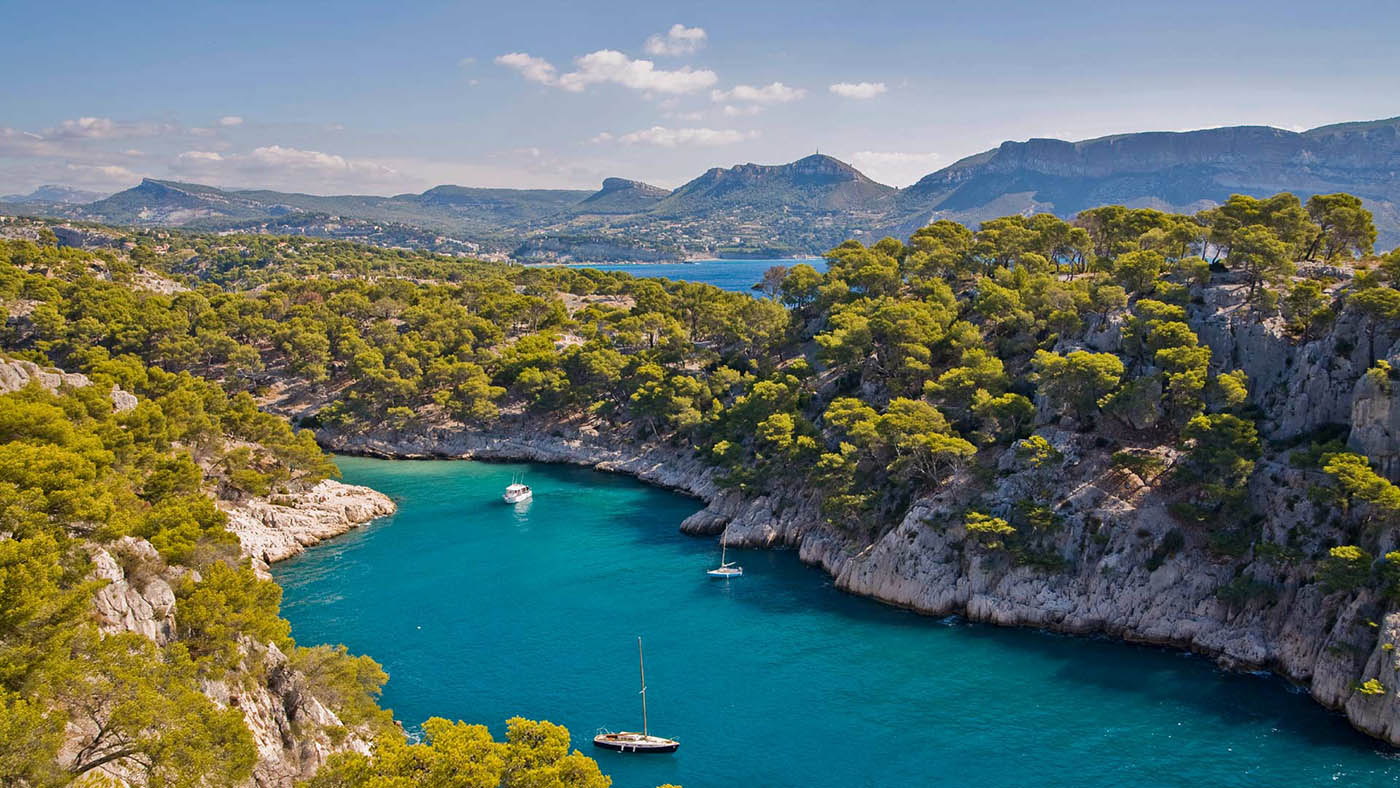
Between Cassis and Menton, the rock changes at almost every headland: the white limestone of the Calanques, the red porphyry of the Estérel, the red sandstone of the Rocher de Roquebrune, the crystalline cliffs of Cap Sicié. And the most striking natural wonders are not always by the sea: some hide in a gorge in the hinterland or at the heart of a car-free island. Here is where to see them, and how to get there without running into a closed road or an off-limits massif.
Updated October 2026
At a glance
- Where: from the Calanques to the Gorges du Loup, by way of the Estérel, the Golden Isles (Îles d’Or) and the Lérins Islands.
- When: autumn to spring for walking; summer for the islands and rivers, early in the morning.
- Getting there: by car for the hinterland, by boat for the islands. In summer, check the massif access map the evening before.
- Who it’s for: walkers, curious families, geology and photography enthusiasts.
The red rocks of the Estérel
The Estérel is a massif of volcanic origin. Its red porphyry stands out against the green of the maquis, the Mediterranean scrubland, and the blue of the sea: it is the massif’s signature, all the way from Saint-Raphaël to Théoule-sur-Mer.
To see it from above, climb the Pic du Cap Roux. From the Sainte-Baume car park, the “petit tour” (short loop) is 4.3 km with about 380 m of ascent. You pass beneath the rocky mass of the Saint-Pilon before reaching the viewpoint indicator at 453 m. To see it up close, the Pointe de l’Aiguille in Théoule follows red porphyry cliffs along an easy 2.5 km.
- Underwater: a guided snorkelling outing of about two hours explores Cap Dramont and the Île des Lions. A glass-bottom boat trip also leaves from Agay.
- By car: the Corniche d’Or links Saint-Raphaël and Mandelieu-La Napoule, high above the red coves.
The Rocher de Roquebrune-sur-Argens
Between the Maures and the Estérel, this block of red sandstone rises out of the Argens plain to a height of 376 m. A listed site since 1989 and part of the Natura 2000 network, it bears at its summit three crosses sculpted in the early 1990s by Bernar Venet. The artist drew on crucifixions painted by Giotto, Grünewald and El Greco. A local legend links the rock’s three fissures to the three crosses of Calvary.
- Hiking: about 6 km, 2 hours 30 and 350 m of ascent to the summit. The route is rated difficult because of some steep sections.
- Another angle: the Base du Rocher, on the Argens, offers canoeing, kayaking and paddleboarding at the foot of the cliff.
The Gorges du Blavet, at Bagnols-en-Forêt
Another side of the Estérel, far from the sea. The Blavet has carved its way through red rock, which you look down on from an observation point. The shaded path passes the Grotte du Muéron and the remains of 18th-century millstones.
- Hiking: 6 km, about 3 hours, 141 m of ascent, starting from the Gorges du Blavet car park.
- Best time: spring, for the wild orchids.
Insider tip: the Estérel, the Blavet and the Rocher de Roquebrune are all in the Var, where access to the massifs is regulated in summer. The map for the following day is published every day before 7pm on risque-prevention-incendie.fr/var. At red level, access is banned outside the designated public reception areas; at black level, all massifs are closed.
The Falaises Soubeyranes and Cap Canaille
Between Cassis and La Ciotat, the limestone gives way to ochre and rust-coloured cliffs that drop sheer into the sea. The path across the Plateau de Soubeyran leads to the Rocher de la Grande Tête, the highest point at 394 m. From the Sémaphore viewpoint you can see La Ciotat and the Île Verte, with the Bec de l’Aigle rock.
- On foot: 7.4 km there and back, about 3 hours, moderate, starting from Cassis.
- Without walking: the Route des Crêtes has several viewpoints you can reach by car.
The calanques of Cassis
Port-Miou, Port-Pin, then En-Vau: three calanques, the region’s steep-sided rocky inlets, follow one another on foot from the port of Cassis. At the far end of En-Vau, the beach is hemmed in by vertical rock walls. The route from the Bestouan peninsula is 7.5 km there and back, about 3 hours 30 of walking, including the tricky Portalet section.
- Good to know: there is no drinking water along the way.
- Summer: in the Bouches-du-Rhône, access to the massifs is regulated from 1 June to 30 September. Each massif is open or closed for the day, according to a map published at around 6pm the evening before.
- On the Marseille side: in high summer, the Calanque de Sugiton can be visited only with a free reservation, according to a calendar published by the Calanques National Park.
Cap Sicié and its crystalline cliffs
West of Toulon, between Six-Fours and La Seyne-sur-Mer, Cap Sicié marks another change of rock: here the cliffs are crystalline. The site covers about 900 hectares, protected under France’s landscape law (loi Paysage) and the Natura 2000 network. The chapel of Notre-Dame du Mai, perched at more than 350 m, serves as a landmark for walkers.
- Getting there: about 2 hours 30 on foot to the chapel from the Quicon, Francillon or Janas car parks.
- Summer: the roads through the municipal forest are closed from 15 June to 30 September, and some car parks can only be reached outside that period.
The Gorges du Loup
In the hinterland behind Grasse, the Loup river runs down from Andon towards the sea, cutting gorges between Gourdon and Courmes. The Cascade de Courmes, more than 40 m high, is a listed site. At the Saut du Loup, a private site, a viewpoint looks down on the Grande Marmite, a pool hollowed out by erosion. You will also come across the Cascades des Demoiselles and the petrifying waterfalls.
- Canyoning: river hiking here is done with a state-qualified guide, from the age of 8, with optional jumps.
- Family swimming: further downstream, the Parc départemental des Rives du Loup (55 hectares, a Natura 2000 site) has three entrances: Villeneuve-Loubet, Cagnes-sur-Mer and La Colle-sur-Loup.
- On foot: the Chemin du Paradis climbs from Le Bar-sur-Loup to Gourdon, over more than 8 km with about 520 m of ascent.
Insider tip: you can see the Cascade de Courmes from the road, but there is nowhere to park and stopping there is dangerous. Do not pull over on the verge. To get close, join a guided canyoning outing.
The Lérins Islands
About twenty minutes by boat from Cannes, Île Sainte-Marguerite is covered by a forest of roughly 170 hectares, planted from the early 19th century onwards: Aleppo pines, stone pines, maritime pines, holm oaks and cypresses, followed later by eucalyptus and cedars. Near the landing stage, the Étang du Batéguier pond attracts migrating birds. A botanical trail introduces the main Mediterranean species.
Smaller Île Saint-Honorat is home to the Abbaye de Lérins, where a community of monks lives. The vegetation is dense and the calm almost complete.
Port-Cros, at the heart of a national park
The smallest of the Golden Isles is the core of the Port-Cros National Park, billed as Europe’s first marine national park. No cars, no bikes: you get around on foot, on small waymarked paths. La Palud beach and the Vallon de la Solitude are among the classic stops.
- Getting there: shuttle boats all year round from Port Saint-Pierre in Hyères, a crossing of about an hour. There are free car parks at the port.
- Summer: the island’s forested areas may be closed depending on the wildfire risk. Check the day’s colour before you board.
Porquerolles and the Île du Levant
Porquerolles, about 12 km², has two faces: fine sandy beaches to the north, and to the south steep cliffs hiding small calanques. In the middle, the cultivated plain is home to the collections of the Conservatoire botanique national méditerranéen, the national Mediterranean botanical conservatory. The crossing from La Tour Fondue, at Giens, must be booked in July and August.
The Levant, to the east, is mostly an off-limits military zone. Only a small part of the island, which belongs to the national park, is open to visitors.
- Good to know: temporary restrictions may apply on the islands’ shorelines. Check with the Hyères tourist office before you set off.
Where to stay
For the Estérel and the Rocher de Roquebrune, Agay, Saint-Raphaël or Roquebrune-sur-Argens make good bases. Hyères is the natural gateway to the Golden Isles, and Cassis to the Calanques and Cap Canaille. For the Gorges du Loup, the villages of Tourrettes-sur-Loup, Le Bar-sur-Loup and Gourdon offer B&Bs (chambres d’hôtes) and gîtes (self-catering cottages).
Our hand-picked campsites in the area, on Yes I Camp: La Plage du Dramont (Agay), Domaine du Ceinturon III (Hyères) and Les Gorges du Loup (Alpes-Maritimes).
See also all our campsites in Provence-Alpes-Côte d’Azur on Yes I Camp.
Further reading
- 15 off-the-beaten-track hikes on the French Riviera
- The secret Estérel: red-rock coves, trails and villages
- Porquerolles, Port-Cros and the Golden Isles: a practical guide
- Secret swimming in the Calanques
- The French Riviera’s gardens: 12 to visit
FAQ
Why are the Estérel’s rocks red?
The Estérel is a massif of volcanic origin. Its rocks are red porphyry, which stands out against the green maquis and the blue sea, from Saint-Raphaël to Théoule-sur-Mer.
Where can you see the Estérel’s red rocks from above?
From the Pic du Cap Roux. From the Sainte-Baume car park, the ‘petit tour’ loop is 4.3 km with about 380 m of ascent, up to a viewpoint indicator at 453 m.
Can you stop to see the Cascade de Courmes?
You can see it from the road, but there is no parking and stopping there is dangerous. To get close, join a canyoning trip led by a qualified guide.
Are the massifs open in summer?
Not always. In the Var, the next day’s map is published every day before 7pm: on red, access is banned outside public reception areas; on black, all massifs are closed. In the Bouches-du-Rhône, from 1 June to 30 September, the map is published around 6pm the day before.